
I started this trip in a warm and humid July at the bottom of Websters Cliff Trail, with a starting height of 1270 ft (387 m.) The trail climbs steeply to Webster Cliffs 3330 ft ( 1014 m) and in the humid conditions I was soon getting warm.

The cliffs provided wonderful views to the south looking over Rte 302 and Crawford Notch. After taking my time to enjoy the view in the sunshine. Leaving this scenic spot the trail heads away from the cliffs and climbs firstly to Mt Webster named after Daniel Webster, then Mt Jackson named after Charles Thomas Jackson a Geologist.

The trail is well used and very rocky in parts, the signs of erosion are very evident and given that only walkers pass through here it is apparent that over the years much damage has been done to the surrounds. This is one reason why camping is restricted to certain areas within the White Mountains.

For this trip I had decided to stay at the Appalachian Mountain Club Huts along the trail, it meant that I did not need to carry morning and evening meals nor did I need to carry a tent. This was my first experience of such accommodation and provided for some interesting moments. The first hut to stay at was Mizpah Springs hut. The hut was built in 1964 and is intended to cater for about 60 people there is a large dining area seen on the right in the photo and the bunkhouses are to the left.


This section of the trail seemed to go on for ever and was certainly a test for the feet and legs. For this trip I was wearing a pair of lightweight Solomon Mid Boots (no longer available)

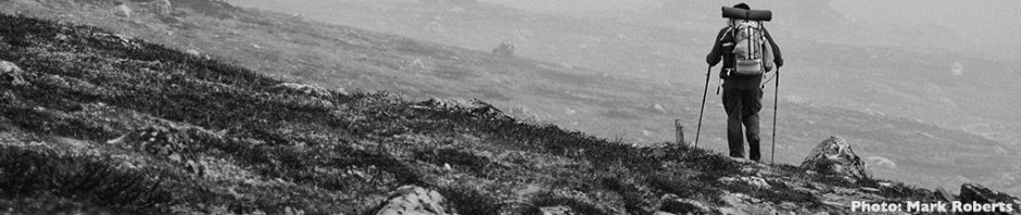
Once above the treeline the first views of the Presidential Range appeared including the cloud covered tops of Mt Eisenhower and Mt Franklin.

As I climbed, down in the valley to the north west the Mt Washington Cog Railway locomotive which gradually climbed the hill to its terminus adjacent to Mt Washington. It climbs gradients as steep as 37% making it second only to the Alpnachstad to Pilatus Kulm railway in Switzerland.


As the mountains were in cloud I skirted the sides of Mt Eisenhower and Mt Franklin along the Crawford Path. the oldest hiking trail in the USA, before reaching the Lakes of the Clouds Hut, in time for lunch. The hut was peaceful at this time of the day and I spent some time just enjoying the view out towards Mt Washington

After lunch the cloud had lifted so I decided to head back along the trail but this time I chose to climb over Mt Franklin and back to Mt Eisenhower. The view along the range towards Mt Washington with just a hint of cloud on top was very enjoyable.

By the time I had returned to the Lake of the Clouds hut, the place was full of hikers staying the night, many had walked the short distance from a carpark at Mt Washington whilst others had come from further afield.

I was up early the next morning and soon begun the climb up to Mt Washington, standing at 6288 feet (1916m). Mt Washington is renowned for its high winds with maximum speeds of 231 mph (372 km/h) being recorded in 1934, fortunately it was not that windy during my visit, but it certainly was breezy. The photo below was taken by the webcam at Mt Washington, you will note that there was no one else there when I visited, this is not often the case.

After leaving Mt Washington the trail descends before climbing past Mt Clay (also known as Mt Reagan), providing views of the Great Gulf Wilderness area.

The day grew colder and overcast and the wind increased, as I climbed Mt Jefferson (named after Thomas Jefferson. At Thunderstorm junction (interesting name) I took a lesser used trail over Mt Adams (named after John Adams), before descending steeply to Madison Spring Hut seen to the left in saddle in the photo below.

Madisons Springs Hut, was built in 1888 and has just been renovated, it was a magical place and whilst small it provided a wonderful environment for walkers to meet and chat. This was my favourite hut.

The next morning, my last on the Presidential Range, was sunny and I followed the high trail along Osgood Ridge, it provided magnificent views to the west towards Mt Washington.


As I descended the towers on Mt Washington became visible as did the smoke Mt Washington Railway as the train climbed to the top.

My final night was spent at Joe Dodge Lodge at Pinkham Notch the following morning I caught the early bus to Boston and then train to a rainy New York. It had been a memorable trip one that I would happily repeat, along spending more time exploring the area.


Great trip report! I did the same hut to hut you did, and enjoyed it very much, although I think I liked Lake of the Clouds (Crowds) best. That is where the blog photo for Trail Ready was taken. No matter, the entire range is a great adventure.
Very envious, hope to go there one day.
Nice post, that is a wonderful section of the A.T.. I have mixed feelings about it though, as when I thru-hiked it in 2006, I found the hut system a bit stressful after all the freedom further south. Competing for a table-top to sleep on, leftovers for dinner… We had foul weather on Washington and Madison, but lovely days otherwise. And there's an A.T. tradition of flashing your bare arse at the train-trippers – unfortunately I didn't learn of it till later!
Thanks Goat, had not heard about the train travellers entertainment, will remember next time I am in the area.
It is certainly worth the trip and doable in a week or so from Dk.
Thanks George, I think Lake of the Clouds with a few less people there is possibly a better place, thanks for the tip on the blog photo I had not noticed.